

New map puts County’s bird species in the spotlight
Administrator | Apr 27, 2016 | Comments 6
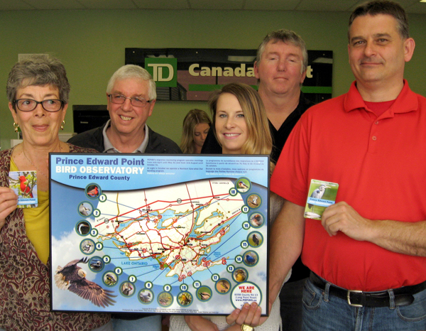
PEPtBO president Cheryl Anderson displays the new Birding Map of the County with photographs by Daniel LaFrance and Gilles Bisson, posing with staff from TD Canada Trust.
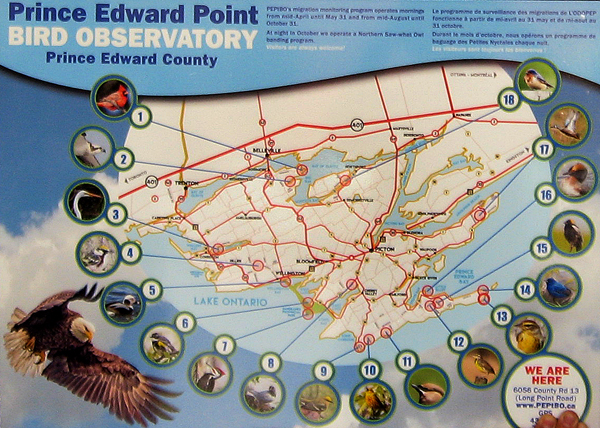
Prince Edward Point Bird Observatory celebrated Earth Day this year by launching its new Birding Map of the County.
The map identifies and describes 18 birding sites in the County in both of Canada’s official languages. It is in a compact folded format that allows for easy transport in a pocket or back pack.
The design and production of the map was overseen by local graphic designer Sacha Warunkiw. Local photographers donated stunning photo illustrations. Recent County “newbie” and PEPtBO volunteer, Hélène Tremblay contributed text translation – and PEPtBO volunteers Peter Fuller and Cheryl Anderson wrote the site descriptions.
Anderson said the new map was inspired by one produced in the early part of the century by Myrna Wood and Terry Sprague.
 “We are very excited about this new birding map,” said Anderson, PEPtBO president. “It will give visiting and local birders information about special sites to visit in the County and tell them about the species they can expect to see at those sites.
“Prince Edward County is becoming a well-known birding destination and visitors to the Bird Observatory always want to know about other places in the County they can visit to see birds. This map will give them that information in a convenient and comprehensive form.”
The project was funded by a grant from the TD Friends of the Environment Foundation and the NatureHood program of Nature Canada and Environment Canada.
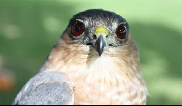
Cooper’s Hawk photographed by David Okines, 2015 PEPtBO bander in charge
Filed Under: Featured Articles
About the Author:


What an outstanding new resource, Cheryl and company! I was delighted to be given one at the PECFN meeting last week! It is very appealing to look at and incredibly informative for a small map; and that format – folding into pocket-size – is brilliant! Thanks for all your work on this – hoping and praying that we are able to protect the birds (and other species) from the various developers that want to trash their habitat and critical migratory stop-over area….
Molly Mulloy
There is no news from the Ostrander Point ERT. There is an old adage that says “no news is good news”, but I wouldn’t want to jinx the result by saying that. We are just patiently waiting.
Hi Cheryl. When oh when is the ERT going to rule on Ostrander Point?
the maps are available free at the Bird Observatory.
Where can we purchase one of these maps?
Well done, Cheryl, PEPtBO and TD Friends of the Environment. And just in time for Spring Birding Festival.