

Letter to Premier seeks continuation of aerial photo program
Administrator | Apr 30, 2015 | Comments 0
Councillors will be asked to endorse a County of Peterborough letter requesting the continuation of the Ontario Imagery Strategy program used to obtain high quality aerial images.
 The letter asks Premier Kathleen Wynne and Minister of Natural Resources and Forestry Bill Mauro, to continue the program beyond 2017.
Since 2008, the County has participated in the program, led by Land Information Ontario, a branch of the MNRF. The program includes private and public sectors who share the cost of highlty detailed aerial imagery captured remotely using fixed-wing aircraft. The program is available every five years for partners to refresh their imagery.
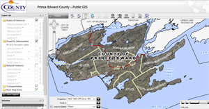
A report to Committee of the Whole Thursday afternoon notes the program has allowed the County to acquire the valuable aerial imagery for a fraction of the cost – in 2008 and 2013. County staff use the photos and share them with the public via the GIS web application. Imagery is often the first layer turned on when examining planning, land and building applications for land use purposes.
The shared cost is $4,671.10, a savings of approximately 90 per cent of the $51,500 cost to obtain its own aerial imagery program.
Prince Edward County Public GIS:
Filed Under: Local News
About the Author: