

Satellite imagery detects algae blooms in bay
Administrator | Nov 04, 2015 | Comments 0
 The Bay of Quinte Remedial Action Plan and Lower Trent Conservation have implemented a pilot project using satellite technology to identify blue-green algae blooms in the Bay of Quinte.
Satellite imagery is used in a wide variety of applications including monitoring water quality, land use changes, deforestation rates and urban sprawl to assessing damage from natural disasters such as fires and floods.
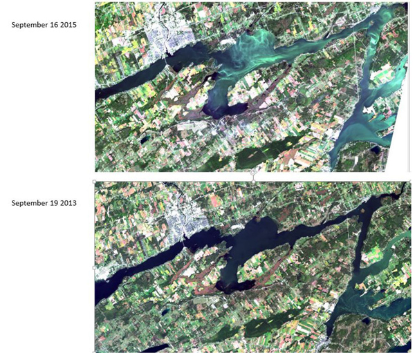
NASA’s Landsat satellite imagery has a 30-year history of detecting algae in inland lake/reservoirs. Lower Trent Conservation purchased the software necessary to interpret and analyze the satellite images.
As the satellite obits the earth it takes images that cover approximately 30,000 square kilometers and the images are divided into 30 x 30 metre cells, and each image provides approximately 2,000,000, sample areas of the bay. The satellite will provide images of the bay approximately every 10 days. The satellite uses wavelengths of light to identify colour differences and algae shows up in the brightest green/yellow light spectrum, due to the presence of chlorophyll within their cells.
The data gathered over the next couple of years will be used to develop a model that will estimate algae concentrations in the bay. This will be an additional tool to complement the traditional efforts of the public reporting of algae sightings to the MOECC Spills Action Centre.
Filed Under: News from Everywhere Else
About the Author: