
Smartphone-enabled maps help track your location in Quinte Conservation areas
Administrator | Dec 01, 2021 | Comments 0
 Nature enthusiasts and lovers of Quinte Conservation’s areas have a new way to discover their favourite green spaces with the Avenza Maps app.
“Using this simple app will allow visitors to navigate our trail systems with unprecedented confidence and without fear of getting off-course – especially in sudden poor weather conditions,” said Connor Dennehy, Quinte Conservation’s GIS Assistant.
“Once maps have been downloaded, guests can track their location on the conservation area trails without requiring the use of mobile data, which we hope contributes to the best and most effortless experience on our trails,” Dennehy added.
The smartphone-enabled maps are now available for 11 of Quinte Conservation’s areas around the
watershed, including:
• Beaver Meadow
• Depot Lakes
• H.R. Frink Centre
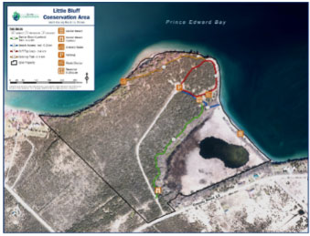
• Little Bluff
• Macaulay Mountain
• Massassauga Point
• O’Hara Mill Homestead
• Potter’s Creek
• Sheffield
• Sidney
• Vanderwater
Those interested in using the new map service may download the free Avenza Maps app on iOS and Android. Instructions for using the app can be found online at QuinteConservation.ca on the conservation area pages.
Filed Under: News from Everywhere Else
About the Author: