

Virtual tour of County’s conservation areas inspires real-time visits
Administrator | Oct 01, 2020 | Comments 1
By Sharon Harrison
Naturalist Terry Sprague gave Prince Edward County Field Naturalists and friends a virtual insight into the County’s 10 conservation areas.
Sprague highlighted history, flora and fauna specific to each area, throwing in a few personal and interesting anecdotes along the way.
“It seems I have been leading hikes for as long as I can remember,” said Sprague who has worked with conservation authorities and areas since 1965, when the Prince Edward Region Conservation Authority was first founded. He was also a naturalist at Sandbanks Provincial Park, columnist and operator of Nature Stuff Tours and Things for several decades.
About 25 participants joined the virtual meeting, something Amy Bodman, PECFN vice-president, noted was a first for the group to meet together.
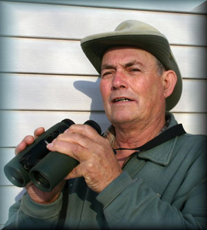
Terry Sprague
Introducing Sprague, PECFN member Sheila Kuja noted he had retired so many times, they had stopped counting. “But we are too happy that he continues to give us his amazing presentations, take us on guided walks and write interesting articles for us.
“He’s our go-to guy for information about the County and, if he doesn’t know the answer to a question we have about natural history, or even about the history of the County, he knows who to ask.”
Sprague explained there are about 250 conservation areas in Ontario, and every one of the 36 conservation authorities has its own conservation area, many of which Sprague said he has visited.
All the conservations areas in this region are managed by Quinte Conservation, and Sprague says that includes 6,200 square kilometres of watershed.
“There are several watersheds involved there, the Moira, the Napanee, the Salmon River, as well as Prince Edward County.”
Quinte Conservation owns about 30,000 acres of land.
“That’s not all conservation area, some of that is conservation lands which may be rented out to hunters to use, and there may be managed forests, but within their total there are about 8,500 acres that we consider conservation areas that the public is welcome to come to.”
Sprague’s talk focused on the 10 areas located within Prince Edward County. They include Massassauga Point, Harry Smith, Demorestville Dam, Henry Leavens, Beaver Meadow, Macaulay Mountain, H.J. McFarland, Rutherford Stevens, Milford Mill Pond and Little Bluff.
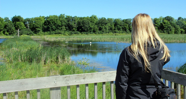
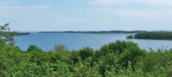
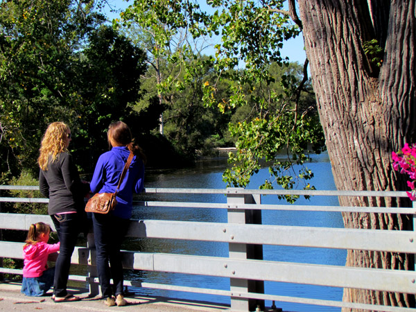
Visitor at the Beaver Meadow lookout
BEAVER MEADOW CA
He noted the first conservation area purchased was in 1969.
“I was on the board then and we were sitting around for four years waiting to find some property that we could own and Beaver Meadow came up for sale,” he said, of the 240-acre property.
“There is a lot of history that dates back to 1910 when a man named George McMullen owned the property and you can still see some of his earlier efforts, some of the foundations etc.”
Sprague describes how a causeway went over the water, and is still there.
“When we first bought the property, we felt we needed to do something to attract wildlife and we knew nothing about native shrubs, it wasn’t even a term you heard, but we did know about some shrubs that produced berries.”
“We ended up bringing a few invasive species, but they have done very well and one of those is called caragana, also known as Siberian pea tree, and it provides food for birds.”
He says there are also a lot of sumacs planted there, as well as autumn olive and Russian olive, both of which are invasive species.
“There are a number of species there, which by today’s standards, you probably wouldn’t want to plant.”
He says the area by the parking lot used to be an open hayfield when the property was purchased, noting how it has changed a lot over the years and was heavily treed.
“I remember in the winter of ’69, we actually drove the tractor and trailer over the causeway, over the ice, and that was the only way in. The official entrance we know today wasn’t even there.”
“I like to go to Beaver Meadow first thing in the morning. It’s absolutely gorgeous to get there just when the sun is coming up and there is a mist over the water and that’s when you hear all the different birds singing.”
Sprague says Beaver Meadow was managed by Ducks Unlimited, and was originally a very popular duck hunting area.
“They came in and constructed a weir and the purpose of the weir was to have a periodic draw down and this draw down, by removing the stop logs in the weir, would allow all the water to drain out of Beaver Meadow and allow some of dormant seeds to germinate and provide food for a lot of the waterfowl.”
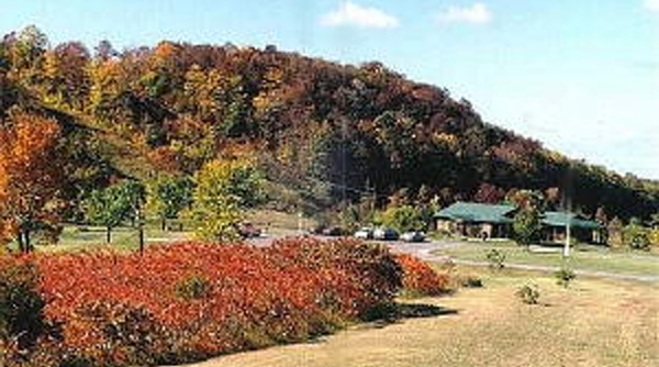
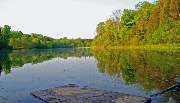
Macaulay Mountain Conservation Area – Terry Sprague photo
MACAULAY MOUNTAIN CA
The next conservation area Quinte Conservation purchased was twice as large as Beaver Meadow at 440 acres, a favourite for Sprague, especially with its beautiful colours in the fall, he said.
“What I like is there are three distinctive land forms. We have the very spectacular east-west escarpment which runs for some length at 200-250 feet in height. We have the low land, and way up on top that extends all the way back to Clarke Road, is a high plateau.” The conservation area also extends across Kingsley Road, although that section is not used much.
He also noted the mountain used to have a downhill ski slope at one time that was very active, which is now part of the trail system.
“It’s not too bad to get up, but it’s an awful to try and get down because it’s so steep,” he says.
Sprague also spoke to the famed Bird House City which was designed and created by Doug Harns, the superintendent of conservation areas at the time.
“He built a nesting box fashioned after the Massassauga Park Hotel,” says Sprague. “He was very gifted when it came to working with discarded wood.”
That particular nesting box has 64 compartments for purple martins, with 3,000 hand-crafted shingles.
“He figured if one bird house looked good, a few more would look better, so he got together the community and they built some more nesting boxes, all fashioned after historic buildings in the County, and some of them not so historic.”
Sprague says there are lots of birds on Macaulay Mountain because of the habitat.
“There is a winter wren, oven bird, wood thrush, great crested flycatcher, these are all regulars during the summer you can always depend on them.”
There are also plenty of different flowers and plants.
“This is maidenhair fern and I’ve only ever found one little cluster of it, but it is always there. Red trilliums, Dutchman’s breeches, and our favourite plant, the four-leaved milkweed, which is only one of three locations in Prince Edward County where they grow.”
Another location is at McMahon Bluff at Black Creek. This year, he said, another bunch was found at Green Point.
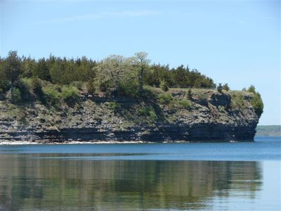
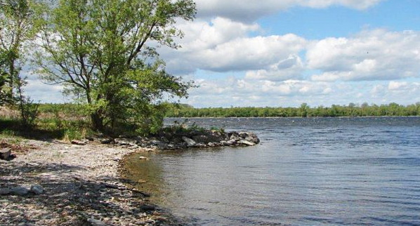
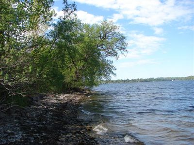
Little Bluff. Quinte Conservation photo
LITTLE BLUFF CA
The Little Bluff Conservation Area, at 70 acres, is very popular, “especially this year when this beautiful area was totally overrun by tourists,” and was subsequently closed, with a review to re-open this month.
The barrier beach is a gravel beach, although Sprague didn’t know how long ago it was formed.
“Like Sandbanks, it closed off an area and it became a cattail marsh and a little pond,” he says. “The cliff is about 60 feet high so it really offers a lot of opportunities.”
Sprague pointed out many people may not realize the seismic station located at Little Bluff is one of 30 in Ontario.
“We do have earth tremors here, none that you would probably feel, but it’s able to pick-up these minute seismic activities and it transfers this to satellites up in the sky.”
He says there are a number of faults in the County.
“One is really clearly seen if you are flying an airplane along the south shore of the County, which extends all the way from Half Moon Point, straight as an arrow, right out into Lake Ontario.”
He also points out how Little Bluff comes with a lot of history because it was the one location that was active during the Barley Days of 1860-1890.
“If you follow the path down the hill to the shore of Prince Edward Bay, you will see the remains of a one-time barley storage building,” he explains, also noting how it was overgrown at one time and was cleared.
Rutherford Stevens lookout. – Quinte Conservation photo
RUTHERFORD STEVENS LOOKOUT
“There are quite a variety of conservation areas, ranging from 440 acres at Macaulay Mountain to one that is so small that it doesn’t even rate an acreage,” said Sprague, referring to Rutherford Stevens Lookout.
“If you get up on the platform and get up on tip toes, you can look over the water of Smiths Bay and you’ll see Waupoos Island and Morrison’s Point, and Timber Island in the distance.”
Harry Smith Conservation Area. – Quinte Conservation photo
HARRY SMITH CA
Located in Ameliasburgh, the Harry Smith Conservation Area comes with a lot of history, including the millpond and the church. Ameliasburgh is also the location of the historic Roblin’s Mill.
“It was disassembled quite a few years ago and rebuilt as a feature in Black Creek Pioneer Village in Toronto and it’s an operating mill.”
“For a long time, there was a trail we tried to keep maintained and there was a trail that completely encircled the millpond,” he says. “It was a very nice trail, quite short, but not too ambitious a trail, but very pretty. Over the years, it just got ahead of us.”
He says the trail deteriorated to the point Quinte Conservation closed it down, but Sprague notes there are portions that can still be walked.
Massassaga Point. – Quinte Conservation photo
MASSASSAUGA POINT
At 60 acres, Massassauga Point Conservation Area has a few features, such as the Massassauga Park Hotel.
“You can still see the walkway going down to what used to be the wharf where the paddleboats and the steamers used to come in and pick-up and discharge passengers,” Sprague says. “It was very active in its day and that’s when shoreline hotels were very popular, like Lakeshore Lodge at Sandbanks, for instance.”
Sprague refers to the Ontario Rock Company, which operated from the 1930s until it closed in 1952, noting it still saw some activity in the 1970s.
“That rock quarry is still there and it’s a very interesting place to go to.”
Demorestville Dam. – Quinte Conservation photo
DEMORESTVILLE DAM
Sprague says while it’s not one of the most popular areas, the Demorestville Dam which provides some water in the back, was formally used for firefighting purposes.
At 65 acres in size, it extends from the parking lot and follows Demorestville Creek all the way up to Black Road.
“There still is a hiking trail that goes along here that I take quite often that goes to Black Road, but years ago it used to go around and follow the other side of the creek back to the control weir,” Sprague says. “When it became a conservation area back in the 1970s, it became completely ravaged by ATVs. It’s an interesting trail and as naturalists, it gets a lot of its water from Fish Lake, but not this year as Fish Lake is really low.”
While there is not a lot of soil there, Sprague notes people have to marvel at some of the plants and animals that eke out a living there.
“If you look hard enough, you can find things in some of the dreariest places.”
Milford Mill Pond. – Sue Capon photo
MILFORD MILL POND
At about 29 acres, Milford Mill Pond includes the mill rights to the pond and the property on at least one side, says Sprague, who notes it also includes the Scott’s Mill.
“At one time, it was open and has a lot of artefacts. Of course, there were a lot of mills in Milford at that time; that’s how Milford got its name.”
H.J. McFarland Conservation Area. – Quinte Conservation photo
H.J. MCFARLAND CA
Named after H.J. McFarland, this conservation area is only about seven acres in size and is across the water from the cement plant. It has a dock and picnic shelters, but Sprague notes that like many conservation areas, it has been prone to vandalism over the years.
“McFarland was mayor from 1951 to 1973 and the longest running mayor in the history of Picton,” explains Sprague. “He donated a lot of land and he was a very generous person. After he died, his wife donated the seven acres to be a conservation area.”
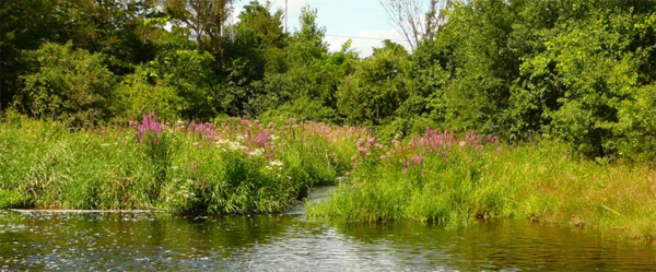
Henry Leavens (Bloomfield Mill Pond). – Sue Capon photo
HENRY LEAVENS
Also known as Bloomfield Mill Pond, Henry Leavens was one of the first chairmen of the conservation authority.
“It is now more a controlled area than a conservation area per se, and it’s a nice area to walk around, and you will always find some swamp milkweed and you are always going to find monarch butterflies.”
Sprague says all the conservation areas have something interesting to offer.
“Whether it is the prairie smoke at Massassauga Point, wood ducks at Beaver Meadow, four-leaf milkweed at Macaulay Mountain, every single conservation area has something of importance.”
He notes the one thing they have had difficulty with over the years with budget cuts is maintenance of the trails.
“We need your support. They are facing hard times now.”
He noted the Adopt-an-Acre fundraising program helps a little, but the recent move to pay for parking has donated an incredible amount of money and has worked out well.
“I hope you get to visit some of these conservation areas and enjoy what they have to offer. There are certainly a lot out there to see.”
The Prince Edward County Field Naturalists’ next meeting is Tuesday, Oct. 27 at 7pm, via the Zoom internet application. All are welcome to hear Dr. Warren Mabee, Director of the School of Policy Studies at Queen’s University, speaking about climate change and new ways of living. Click here for details
Filed Under: Featured Articles
About the Author:


Much appreciated – very informative.